Coastguard : Search Pattern : Visualisation
When sufficient data has been entered to generate the legs of a search pattern and a start point has been entered, the pattern can be visualised on the main map page.
The start point can be taken automatically from the user's current position or the last referenced 'cross hairs' position from the main map.
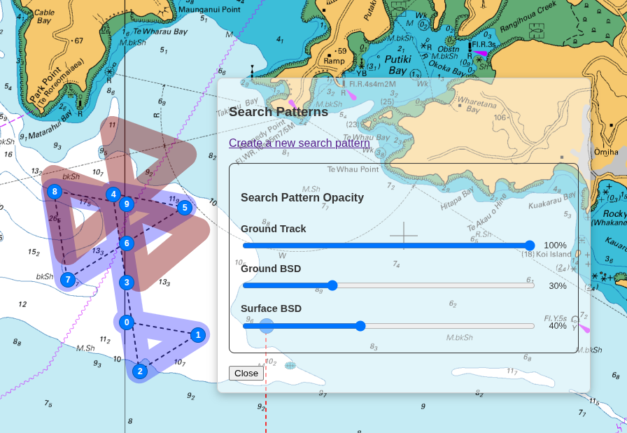
A 'slider' is provided so that emphasis can be drawn to either the search's Course Over Ground or Course Over Surface, demonstrating the effects of Drift on the search pattern.